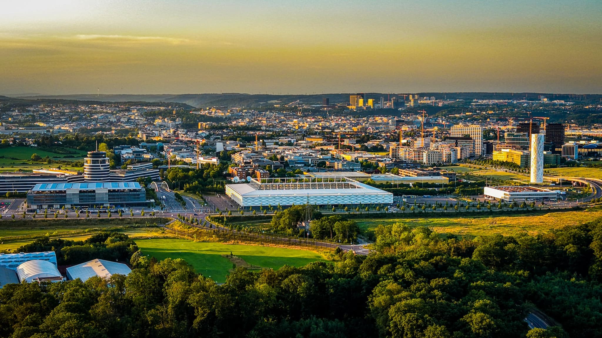
The city ends here. Not with a bypass road or a boundary sign — just a line where the last logistics shed gives way to open ground. Kockelscheuer sits at the southern edge of Luxembourg City municipality, between the Cloche d'Or development to the north and the communes of Roeser and Hesperange to the south. From the ground the transition is imperceptible. From altitude the edge is exact: hard surface, then open ground, then agricultural field.
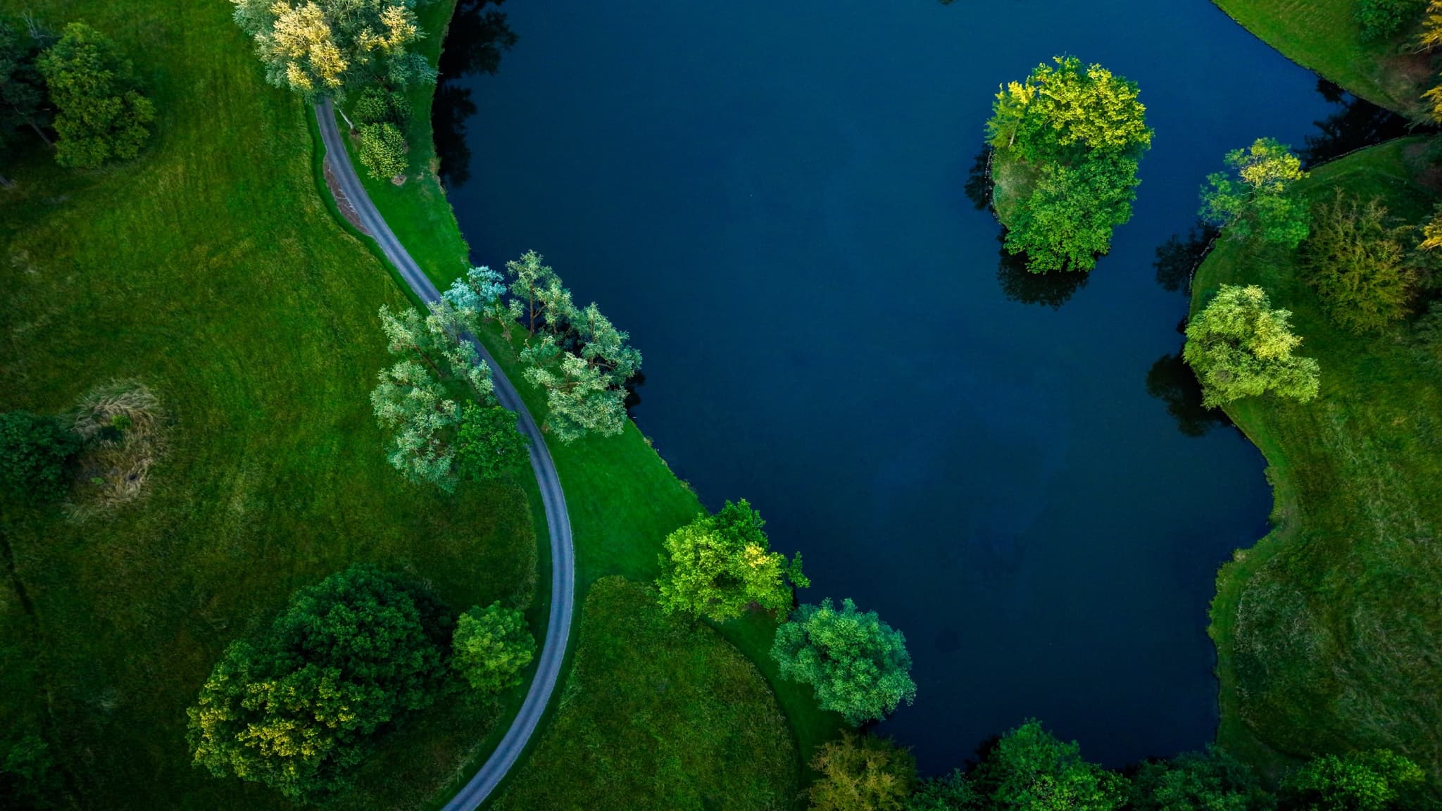
The retention lake from directly above. Built in the mid-2000s to manage stormwater from the Cloche d'Or development. From this altitude it reads as a natural feature — the reed margins have had fifteen years to make it look like it was always there.
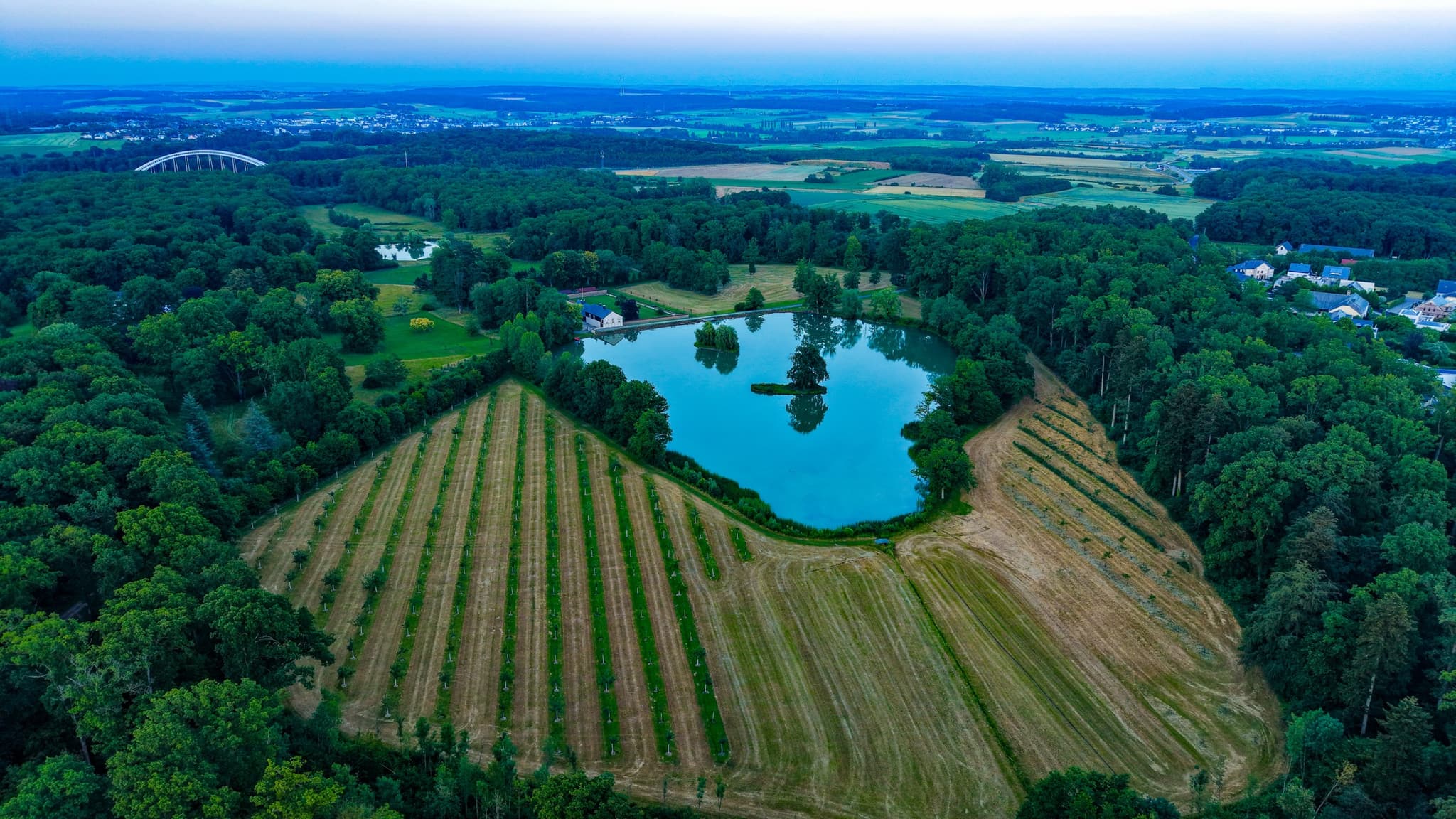
PrintThe two lakes are retention basins. Luxembourg planning law requires stormwater management for large impermeable surfaces, and the Cloche d'Or — a hundred hectares of glass, steel, and logistics — needed somewhere for the rain to go. The lakes were excavated in the mid-2000s as part of the development's infrastructure requirements. They are wholly functional. From above, they read as natural features: irregular outlines, reed margins filling in, the dark water holding the sky. Ten years of reed growth looks like ten thousand years of ecology.
The fields to the south of the park are still being farmed. Short-term leases, renewable on a planning cycle. The farmers who work them do so knowing the development front could reach them within a generation. From altitude the strip crops and tractor lines read as a precise geometry — the same spatial discipline as the city they border, a different purpose. The soil here is good farmland by Luxembourg standards: well-drained loam on a gentle slope, within sight of a city that stopped growing southward at this particular field edge, for now.
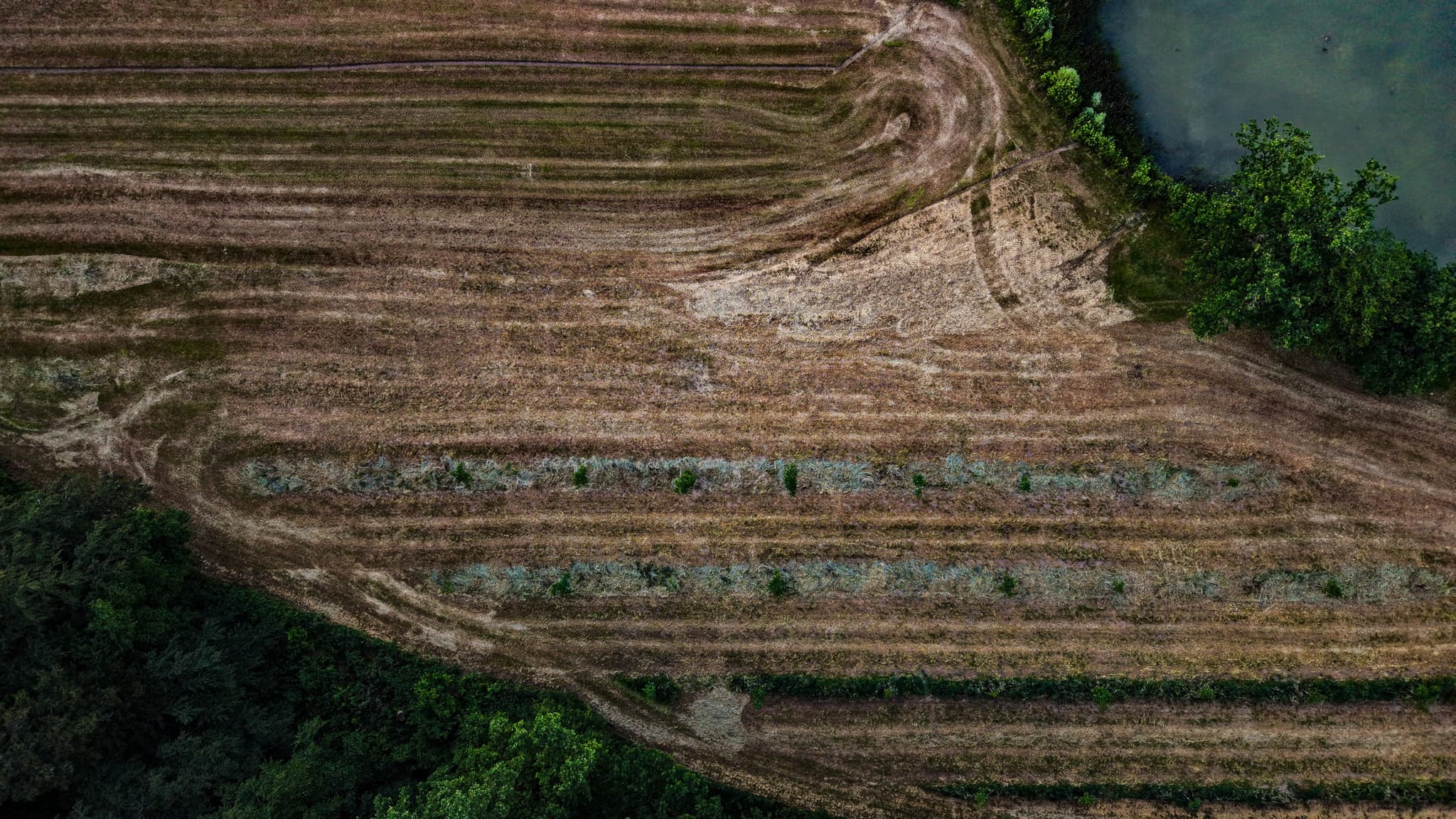
The agricultural fields to the south — strip crops, tractor lines, the geometry of land still in use at the city's edge. Short-term leases on good loam soil, in the path of the next planning cycle.
Print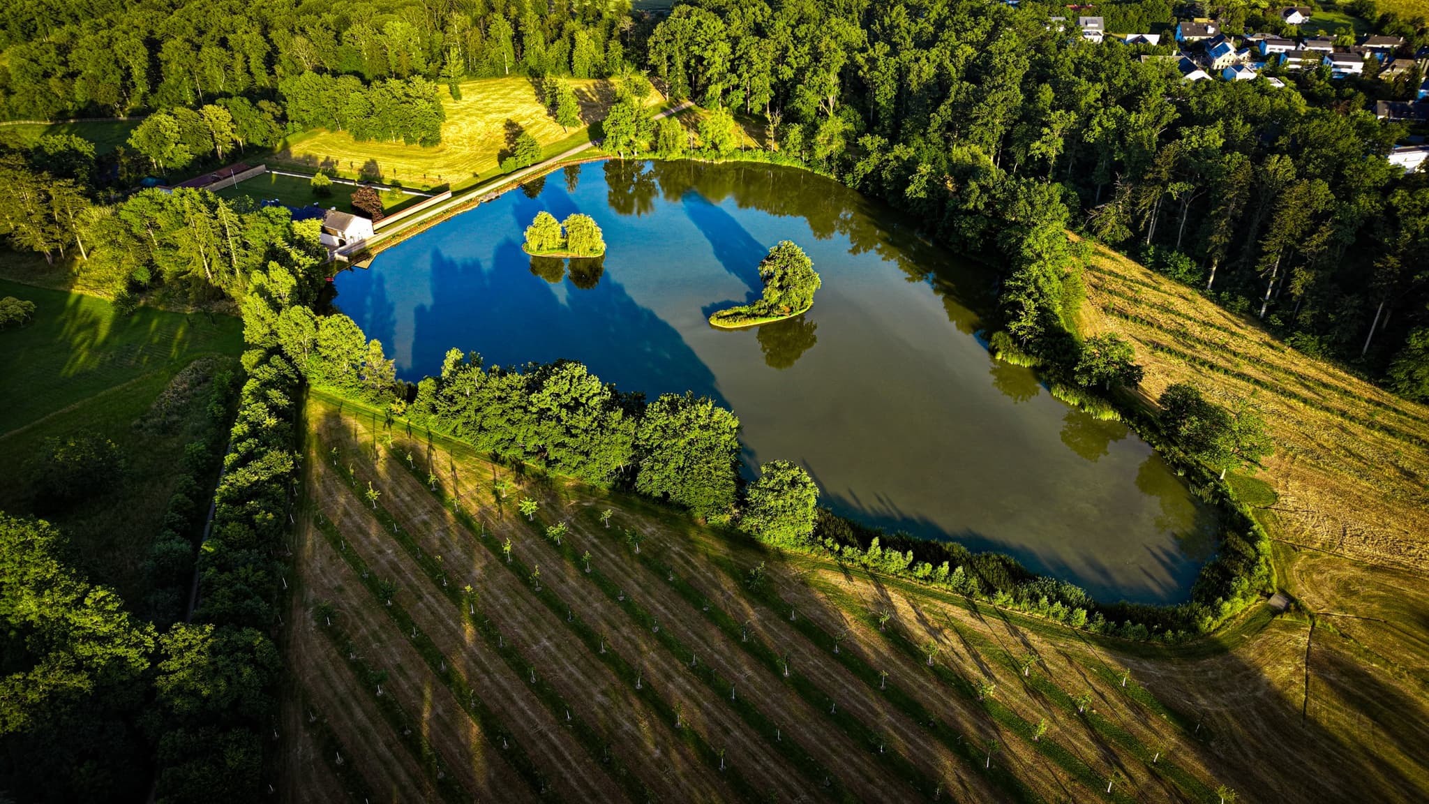
The second lake at 50 metres. Open water, the surrounding park, the development edge visible to the north. The reed margin is still establishing.
PrintIn winter, the park's flat open ground becomes an outdoor ice rink — the Patinoire de Kockelscheuer — which draws the southern suburbs from November to March, then packs away completely as though it was never there. In June the same ground is cut lawn, families with dogs, the city a kilometre to the north and mostly invisible. The park holds both seasons without emphasising either. From the air it reads as what it is: a useful pause at the edge of a city that keeps deciding whether to grow.
The southern edge of Luxembourg City from altitude. The Gasperich towers are visible to the north; the farmland communes begin to the south. This is the line, for now.
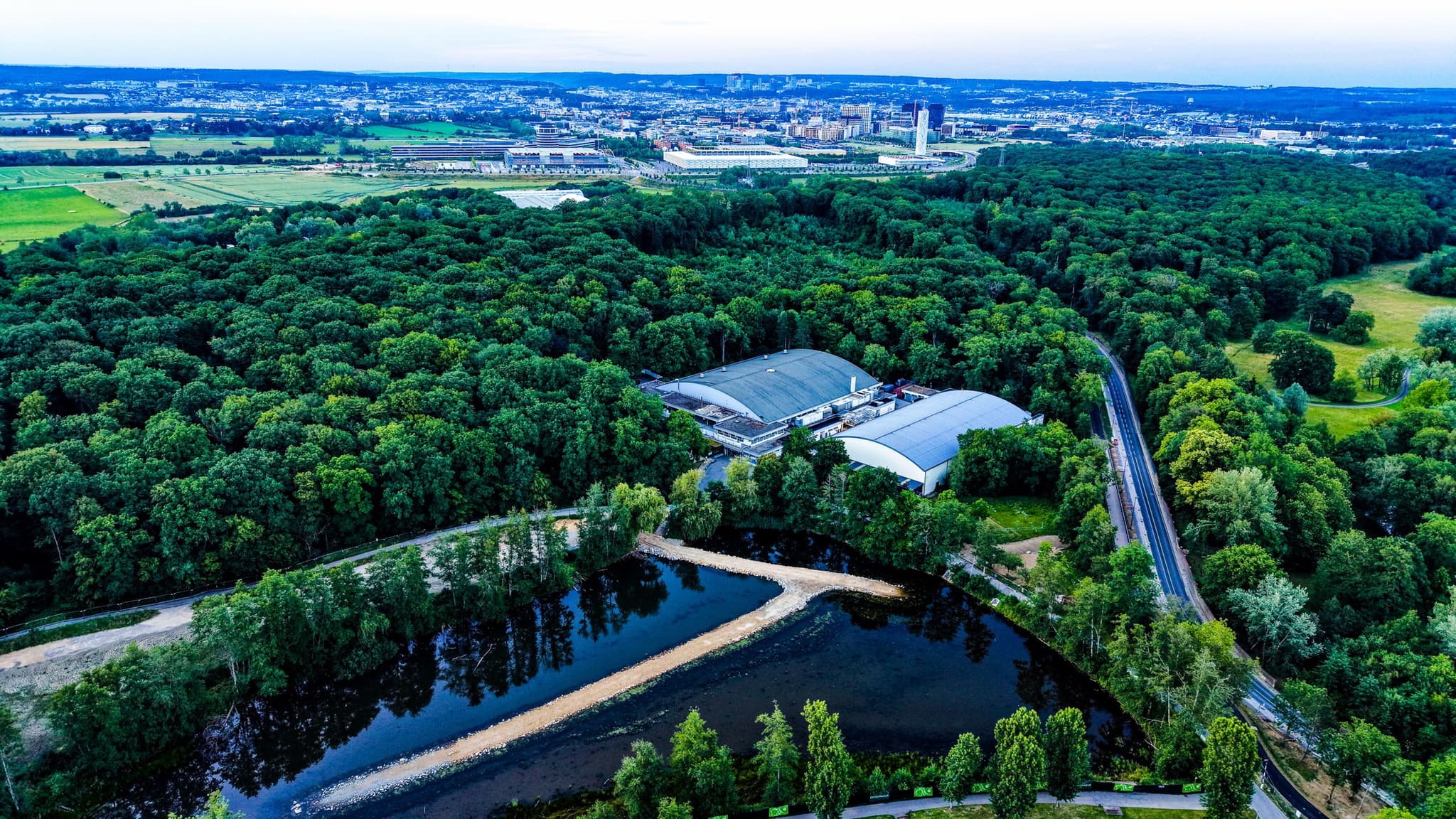
Park and lake in their landscape context — open ground on one side, the city pressing in on the other.
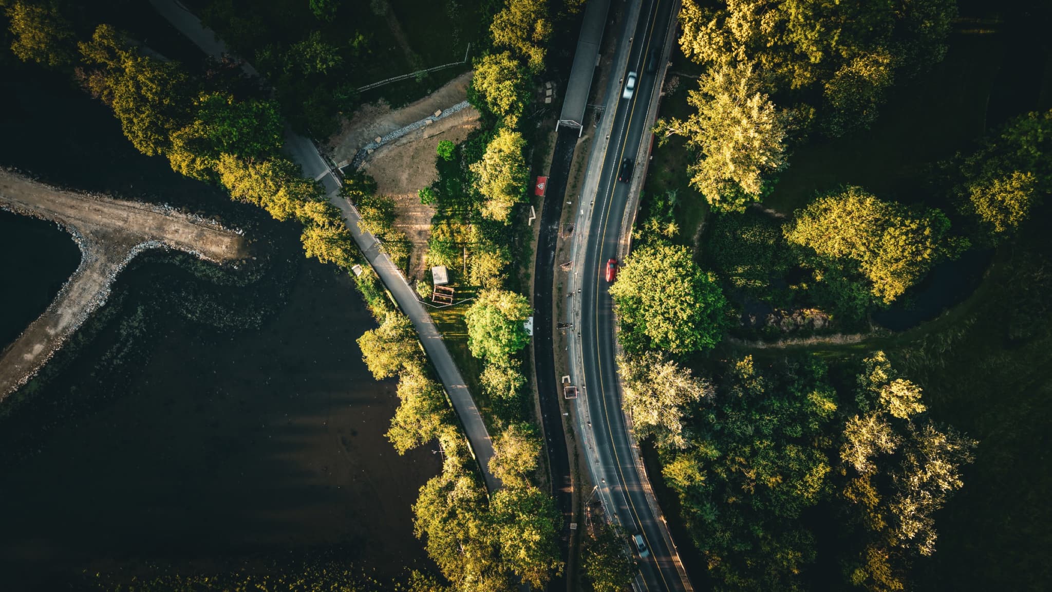
The road crossing at the park boundary — the infrastructure surface where the city begins and the park ends. From nadir the distinction between them almost disappears.

Gasperich in the last light. The Cloche d'Or towers glow at the far edge, the suburb spreads into the frame, and beyond the bottom edge the city simply stops. The same ground that reads as retention lake and field geometry from directly above reads, from here, as a city that doesn't quite know it has ended.
PrintFrom the collection